Spanish island moved by geological movement
 0 Comment(s)
 Print
Print E-mail Xinhua, March 31, 2013


The Spanish island of El Hierro has begun to move to the east and part of it have risen 11 centimeters in height as a result of the recent seismic activity it has experienced, a local media report said on Saturday.
|
|
| Satellite image of El Hierro. [File photo] |
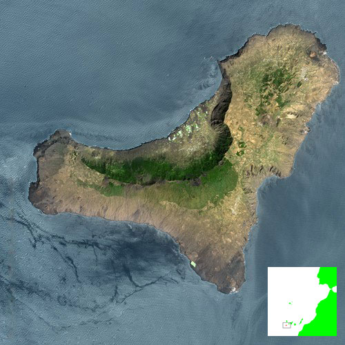
Located at the west end of the Canary Islands, which are situated off the west coast of Africa, El Hierro on Friday suffered its strongest earthquake since the eruption of an underwater volcano off its coast in the summer of 2011, the National Center for Volcanology or Canary Islands Volcanological Institute (INVOLCAN) was quoted as saying.
The quake, which took place off the west of the island with a population of just over 10,000 inhabitants, measured 4.7 on Richter scale and has had the effect of moving the island slightly to the east as a result of the pressure of magma building up under the earth's crust.
Further, the INVOLCAN have informed that the recent activity has caused the ground to rise by 11 centimeters at Punta de Orchilla on the west end of the island.
Friday's quake is the strongest of a series of quakes which have shaken the island in recent days. The latest outburst of activity began on March 18 with the strongest quake registering at 4.7 on Richter scale, while 54 separate tremors were registered off the coast, the majority of them at a depth of between 12 and 15 kilometers.
The El Hierro Island is believed by many to be formed by volcanic eruptions more than one million years ago.


Go to Forum >>0 Comment(s)