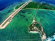
South China Sea record from US library

 0 Comment(s)
 Print
Print E-mail CNTV, July 20, 2016
Many old documents collected by the US Library of Congress have proved China's historical rights over the islands and adjacent waters in the South China Sea.
A world map drawn by Italian missionary Matteo Ricci over 400 years ago shows that the South China Sea was under China's territory during the Ming Dynasty.
The library also has the Zhenghe Sailing Map by the Ming Dynasty government, in which islands and reefs in the waters were given Chinese names.
While another map drawn a hundred years ago shows that the Scarborough Shoal, or Huangyan Island fell out of the Philippines' jurisdiction. The map was made after Spain and the US signed the Treaty of Paris in 1898.


Go to Forum >>0 Comment(s)