China holds detailed survey on Diaoyu Islands
- By Wang Mengru
 0 Comment(s)
 Print
Print E-mail China.org.cn, January 15, 2013


|
|
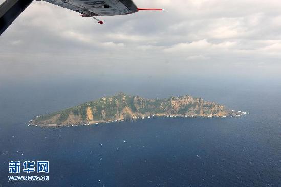
China will release the geographic information obtained from the surveying and mapping project of Diaoyu Islands later this year, according to a Blue Paper issued by the National Administration of Surveying, Mapping and Geo-information yesterday.
The project was launched by the National Administration of Surveying, Mapping and Geo-information in cooperation with the military and civilian surveying and mapping departments.
The first phase of the project has accomplished the national islands geodetic control networks which consist of 770 geodetic control points, according to the Blue Paper.
Meanwhile, the project has also completed the space image acquisition of China's offshore maritime areas, covering a total area of 1.9 mln square kilometers.
China will release the first project data in June, said Li Zhigang, director of the National Geomatics Center of China. However, these first phase data will not include the Diaoyu Islands. The second phase will then cover all offshore maritime areas, including the Diaoyu Islands.


Go to Forum >>0 Comment(s)