Tianjin blast: Before-and-after images show devastation
 0 Comment(s)
 Print
Print E-mail CRI, August 22, 2015


|
|
| The photo taken on June 5, 2015, shows the satellite picture of the core area before the Tianjin blasts. [Photo: cresda.com] |
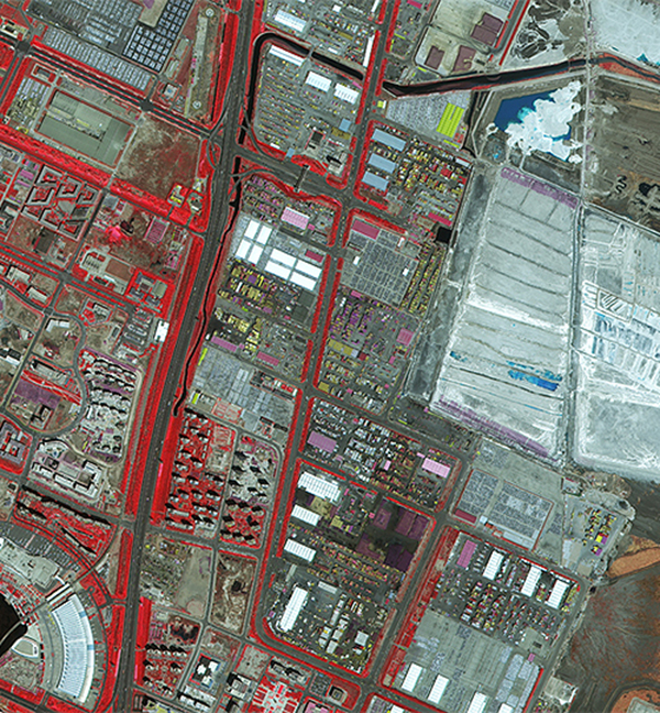
Two before-and-after satellite pictures showing the core area of the Tianjin blasts have been released for the first time.
Before the fatal explosions took place, the parking lots, buildings and roads in the core area could be spotted clearly in the satellite picture.
|
|
| The photo taken on August 17, 2015, shows the satellite picture of the core area after the Tianjin blasts. [Photo: cresda.com] |
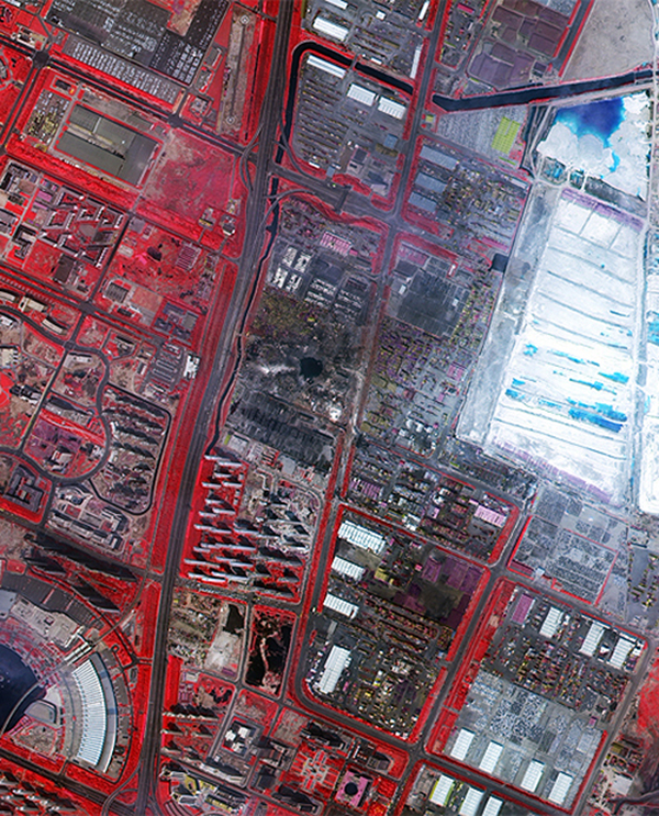
By comparison, in the satellite photo after the accident, it's difficult to see the outline of the roofs of the buildings. A large black crater caused by the explosions was also clearly visible.
After the explosions rocked the city, as an emergency response, several high-resolution remote sensing satellites have been deployed since August 13, to take images of the core area.
The data collected by these satellites have been provided to pertinent departments to help with the disaster assessment and rescue work.
So far, China Center for Resources Satellite Data and Application has obtained and shared a total of 9 pieces of image data of the blast area.


Go to Forum >>0 Comment(s)