| Home / Environment / Ecology and China | Tools: Save | Print | E-mail | Most Read |
| Nujiang River, Fresh for Exploration |
| Adjust font size: |
Nujiang is one of the rivers within the Three Rivers Natural Reserve, a world heritage site listed by UNESCO. It is located throughout southwest China's Yunnan Province and flows into Myanmar, where it joins the Salween River and ends its journey at the India Ocean.
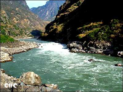
The Nujiang Gorge running from northwest Yunnan to Tibet lies in a narrow strip of land bordering Myanmar, sandwiched to the west by Gaoligong Mountain range and the Biluo Mountain range on the east. It runs through one of China's remotest areas, with carved canyons running through it. However, due to its inaccessibility, the Nujiang River has never been a popular tourism destination.
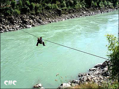
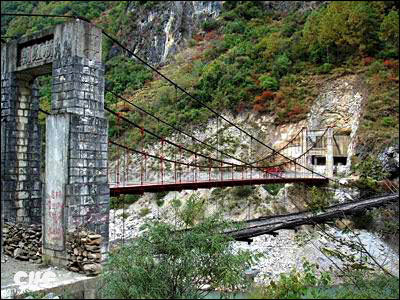
Departing on November 14 from Kunming City, capital of Yunnan, our tour bus arrived four days later at Bingzhongluo where the essential attractions of the Nujiang Gorge are located. The only access to the Gorge by road is from the south via Liuku, Fugong and Gongshan. There are some 922 km from Kunming to Bingzhongluo. Bingzhongluo, the northernmost town of the Gorge, lies only 100 km west of Deqin (Shangri-la), the last town on the Yunnan-Tibet highway. However, no direct road connects the Bingzhongluo region to Deqin. From either location, travelers can follow a local guide and cross the high Biluo Mountain Pass at 4000 meters in altitude. Local tourism officials said that the government is planning to build a road connecting the two cities. An expressway does run from Kunming to Wayao, before the bus has to be driven on a tortuous mountain road. The road winds its way down the gorge slope and the cliff-face hides many hairpin bends. Traffic warnings are erected on most of the dangerous sections by local authorities to reduce traffic accidents. Villages on the other bank of the river are accessed either by narrow hanging bridges constructed with small wooden planks strung together with rattan tied to trees; or by sliding on overhead cables that span the river. The cables are tied to trees on either side of the river and to cross, one is suspended from a rope loop attached to a harness worn around the waist.
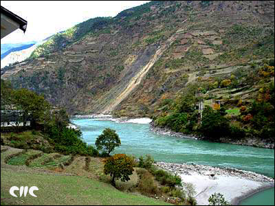
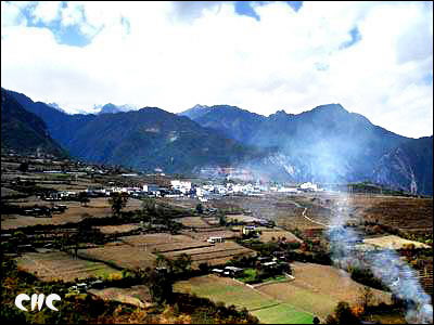
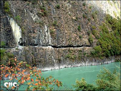
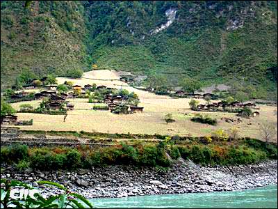
There are easy and beautiful walks to nearby villages along the Nujiang. A few kilometers outside of town, the river widens and cuts through very deep and dramatic gorges. The road hugs the Nujiang and we encountered several landslides along the way. During our trip, there was no rain and some landslides made the road much more dangerous but after some clear-up, we made it through. It is said that the scenery is especially spectacular after rain, but, this also increases potential delays and exacerbates the danger from landslides. Clinging to impossible places on the slopes hundreds of meters up from both sides of the river, farms belonging to the Lisu and Nu people dot the landscape. One cannot imagine people living on such steep inclines. Most mountain inhabitants live in wooden sheds and huts built on the side or even the top of the mountain. The scenery between Fugong and Gongshan is awe-inspiring with many cliffs, clear green river-water and water falls. The first hairpin bend came into sight near Bingzhongluo. Bingzhongluo is a Tibetan-dominated town and is 40 km north of Gongshan County. Gongshan is an autonomous county where 12 ethnic groups live including 3 of the earliest inhabitant minorities, namely the Nu, Drung and Tibetan peoples.
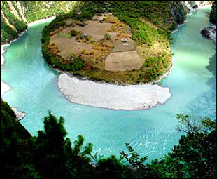
Bingzhongluo is a one-street town. It has a strong Tibetan flavor from its ethnic population and its proximity to Tibet, sheltered away to the north. Many tourists who have been to Tibet said that Bingzhongluo's Tibetans live better lives due to a mild climate and better natural conditions. Small plots of farms spreading out in terraces lie towards the river. Across the river, more farms (mainly growing wheat) stand on a beautiful peninsula jutting into the water -- the "Plum Island". The west of Bingzhongluo is backed onto a few snow peaks.
The most beautiful part of Nujiang Gorge starts from Binzhongluo. Hiking is the best way to enjoy the landscape and an average of 2.5 hours is needed for most tourists to reach the famous "Tea Horse Caravan Route." Renting a mini bus at Bingzhongluo town is an alternative for the less adventurous sightseers.
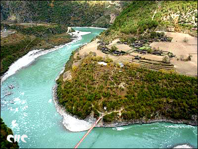
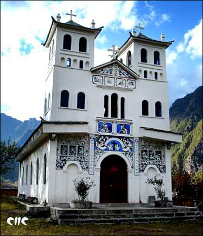
On the way to the "Tea-Horse Caravan Route", one can see the 100-year-old Zhongding Catholic Church built and founded by a French missionary. Shimen Pass is another fantastic section of the gorge along with Wengli (also called Wuli), another stunning landscape lying on a beautiful slope along the river bank. Very near to the Wengli, a carved path is seen on the other bank cliff, the so-called "Tea-Horse Caravan Route", a path used by traders ferrying their goods between Yunnan and Tibet.
At the end of the trekking road, an old hanging bridge and a new one-year-old bridge swing side-by-side. To those wanderlusts, some trekking routes are worthy of spending days or even weeks longer between Gongshan and Bingzhongluo. Getting 90 km further west to the Drung River from Gongshan reveal beautiful virgin forests as well as the kind-hearted Drung ethnic people living their old way of life. Catholicism, Tibetan Buddhism and local religions are very popular and co-exist peacefully. One local young man told me that his family members have three different religions.
Wengli (China.org.cn by staff reporter Wang Zhiyong, November 21, 2006) |
| Tools: Save | Print | E-mail | Most Read |
 |
| Related Stories |
|
||||