|
NATIONAL FLAG, NATIONAL EMBLEM, NATIONAL CAPITAL, NATIONAL ANTHEM|ADMINISTRATIVE DIVISION GEOGRAPHICAL FEATURES|NATURAL RESOURCES|CLIMATE|POPULATION, ETHNIC GROUPS |
|
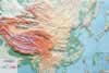
Tarim Basin |
|
Tarim Basin: Located in the southern part of the Xinjiang Uygur Autonomous Region, with its bottom averaging 800-1,300 meters above sea level. |
|
||
|
|||
|
Junggar Basin |
|
Junggar Basin: Located in north Xinjiang, with its bottom averaging 500-1,000 meters above sea level. |
|
Qaidam Basin |
|
Qaidam Basin: Located in the northeastern part of the Qinghai-Tibet Plateau, with its bottom averaging 2,700-3,000 meters above sea level. |
|
Sichuan Basin |
|
Sichuan Basin: Located in east Sichuan Province, with its bottom averaging 400-800 meters above sea level. |
|
Turpan Basin |
|
Turpan Basin: Located in central Xinjiang, with its bottom lying 154 meters below sea level. |