The largest lake in northeast China, Hulun Lake, is experiencing a drastic decrease in its water level and an increase in saline aggravation that has built up over a number of years. The deterioration of the water's environment has seriously threatened north China’s green protective screen -- the Hulun Buir Prairie and the Great Hinggan forest zone.
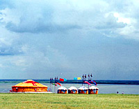
Hulun Lake is in the west of the Hulun Buir Prairie in north China's Inner Mongolia Autonomous Region and at the western foot of the Great Hinggan Mountains where Manzhouli city, Xin Barag Left Banner and Xin Barag Right Banner meet. The water system comprises Hulun Lake, Halaha River, Buir Lake, Orxon River, Herlen River, Xinkai Lake, and Xinkai (or Dalan'eluomu) River that connects Hulun Lake with the Ergun River. The water originates from outside China and empties into the Ergun River.
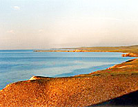
According to statistics from the Water Conservancy Bureau of Hulun Buir city, Hulun Lake has a history of over 100 million years. Its highest water level reached 545 meters with a storage capacity of 13.1 billion cubic meters and water surface covering 2,315 square kilometers. The average water depth is 5.7 meters, with the deepest point reaching 8 meters. Based on these figures, Hulun Lake is rated the largest lake in northeast China and the fifth largest fresh water lake in the country.
However, due to insufficient harnessing work on Hulun Lake, damaged ecology to its surroundings and the water supplying its riverbanks as well as adverse natural conditions, the water level of the lake has decreased by a significant margin, with saline-alkali deposits increasing. The PH value of the water has risen, resulting in a dramatic deterioration of the lake’s water environment.
Statistics from the Water Conservancy Bureau of Hulun Buir city show that the water level of the lake has decreased by 1.8 meters since 1999. In addition, the chemical oxygen consumption and content of ammonia, fluoride, and mercury in the lake have increased year by year.
The worsening ecology of the lake has adversely influenced its surrounding environment. The nearby wetland in the Great Hinggan forest zone has shrunk in acreage and large areas of reeds and wetland beside the lake have disappeared. The lake water is no longer drinkable, posing a threat to drinking water supply for humans and livestock inhabiting the area around the lake.
Fish species, including predatory carp (Cultrichthys erythropterus), sweet lip (Brachymystax lenok) and Taimen (Hucho taimen) are almost extinct in the lake and the storage volume of fish and shrimp has decreased. Deterioration and desertification on the Xin Barag Prairie beside the Hulun Lake are severe, with dunes expanding rapidly at the speed of 100 meters per year. Dunes have buried large stretches of pasture and even herdsmen's houses face similar dangers.
Yang Wensheng, head of the Water Conservancy Bureau of Hulun Buir city, worried that the Hulun Lake will turn into a saline-alkali lake in less than 20 years if relevant harnessing measures aren't taken immediately. "When the time comes, fishery resources of the lake will be severely destroyed, and the Great Hinggan forest zone and the Hulun Buir Prairie will further degenerate and desertificate due to inefficient water supply," he said. "Since the soil layer of the Hulun Buir Prairie is relatively thin and the sand layer is thick, its ecological environment, once being devastated and desertificated, will be hard to retrieve."
In this regard, Yang Wensheng appeals for immediate measures to be taken to harness and protect the water environment of Hulun Lake. One of the most effective ways he put forward is to build a water diversion project at the lower reaches of the Hailar River which is connected with Hulun Lake by the Dalan'eluomu River.
(China.org.cn by Zhang Tingting and Daragh Moller, December 22, 2003)