|
Location and Territory | Geographical Features | Natural Resources | Climate |
|
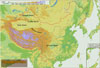
Basins |
|
|||||||||
|
|
|
|
|
Tarim Basin |
|
|
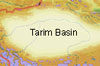 Situated
in the southern part of the Xinjiang Uygur Autonomous Region and embraced
by the Tianshan and Kunlunshan mountains, it is China's largest basin. With
its base averaging 800 to 1,300 meters above sea level, it covers 530,000
square km. The basin, widely covered with deserts, has a terrain descending
from west to east. The 330,000-square-km Taklamakan in the center of the
basin is the largest and the most arid desert, and one of the richest areas
in oil and gas reserves in China. Situated
in the southern part of the Xinjiang Uygur Autonomous Region and embraced
by the Tianshan and Kunlunshan mountains, it is China's largest basin. With
its base averaging 800 to 1,300 meters above sea level, it covers 530,000
square km. The basin, widely covered with deserts, has a terrain descending
from west to east. The 330,000-square-km Taklamakan in the center of the
basin is the largest and the most arid desert, and one of the richest areas
in oil and gas reserves in China. |
|
|
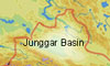
Junggar Basin |
|
|
||
|
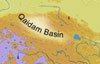
Qaidam Basin |
|
|
||
|
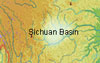
Sichuan Basin |
|
|
||
|
Turpan Basin |
|
|
||