|
|
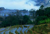
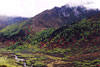
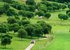
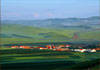
China has many mountains, with mountainous areas, which consist of mountains, hills and plateaus, making up two-thirds of its total land area. Of various landforms, mountains account for 33 percent; plateaus, 26 percent; basins, 19 percent; plains, 12 percent; and hills, 10 percent.
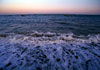
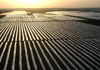
China has a terraced terrain, which descends from the west to the east step by step. The first, or the highest, terrace is the Qinghai-Tibet Plateau, known as the "roof of the world," with an average elevation of over 4,000 meters. The second terrace extends from the Qinghai-Tibet Plateau to the north and east, consisting of the Inner Mongolia Plateau, the Loess Plateau, the Yunnan-Guizhou Plateau, and the Tarim, Junggar and Sichuan basins, averaging 1,000 to 2,000 meters above sea level. The third terrace covers the areas from the Greater Hinggan Mountains, the Taihangshan Mountains, the Wushan Mountain and the Xuefeng Mountain to the eastern coast, composed mainly of plains below 200 meters above sea level, with some hills and low mountains with an elevation of below 1,000 meters. The fourth terrace comprises the sub-littoral zones on the continental shelf, with the average depth of water being less than 200 meters.
| |
 |
 |
 |
 |
| |
89°E:Regional Hypsometric Map |
36°30′E:Regional Hypsometric Map |
30°N:Regional Hypsometric Map |
110°E:Regional Hypsometric Map |
|