|
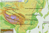
Location and Territory | Geographical Features | Natural Resources | Climate |
|
Main Mountain Ranges |
|
|||||||||
|
|
|
|
|
Himalayan Mountain Range |
|
|
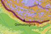 Extending
more than 2,400 km in a crescent-shape along the Chinese-Indian and Chinese-Nepalese
borders, it has an average elevation of 6,000 meters. It is the world's
highest and largest mountain range, and its main peak, Qomolongma, is 8,848.13
meters above sea level, the highest in the world. Extending
more than 2,400 km in a crescent-shape along the Chinese-Indian and Chinese-Nepalese
borders, it has an average elevation of 6,000 meters. It is the world's
highest and largest mountain range, and its main peak, Qomolongma, is 8,848.13
meters above sea level, the highest in the world. |
|
|
Kunlunshan Mountain Range |
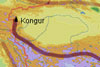 Extending
over 2,500 km from the Pamirs Plateau in the west to the northwest of Sichuan
Province in the east, it has an average elevation of 5,000 to 7,000 meters.
Its highest peak, Kongur, is 7,719 meters above sea level. Extending
over 2,500 km from the Pamirs Plateau in the west to the northwest of Sichuan
Province in the east, it has an average elevation of 5,000 to 7,000 meters.
Its highest peak, Kongur, is 7,719 meters above sea level.
|
||
|
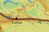
Tianshan Mountain Range |
|
|
||
|
Tanggula Mountain Range |
|
|
||
|
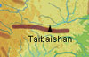
Qinling Mountain Range |
|
|
||
|
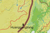
Greater Hinggan Mountain Range |
|
|
||
|
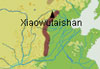
Taihangshan Mountain Range |
|
|
||
|
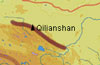
Qilianshan Mountain Range |
|
|
||
|
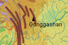
Hengduanshan Mountain Range |
|
|
||
|
Taiwan Mountain Range |
|
|
||